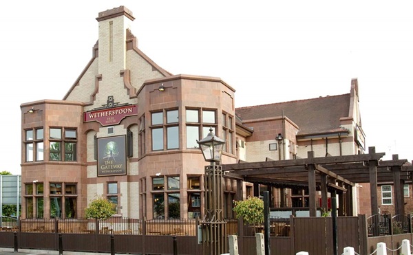
At the junction of Kingsway and Wilmslow Road, The Gateway was built in the 1930s, as a hotel and public house. The adjacent houses were built a few years earlier, in what had been a rural area, until the early 1900s. Now the A34, Kingsway is a former turnpike or toll road leading south. The bar across this private road was lifted only on payment of a toll. The toll bar was situated near The Gateway.
A photograph and text about The Gateway.
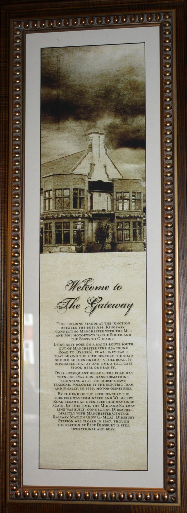
The text reads: This building stands at the junction between the busy A34 ‘Kingsway’ connecting Manchester with the M60 and M61 motorways to the South and the B5095 to Cheadle.
Lying as it does on a major route south out of Manchester (the A34 trunk road to Oxford), it was inevitable that during the 18th century the road should be turnpiked as a toll road. It is possible that at one time a toll gate stood here or nearby.
Over subsequent decades the road has witnessed various transformations, beginning with the horse-drawn tramcar, followed by the electric tram and finally, in 1939, motor omnibuses.
By the end of the 19th century the turnpike was terminated and Wilmslow Road became and open free highway once again. By this time, the Midland Railway line was built, connecting Didsbury directly with Manchester Central Railway Station (now G-MEX). Didsbury Station was closed in 1967, though the station at East Didsbury is still operational and busy.
A photograph and text about The Gateway.
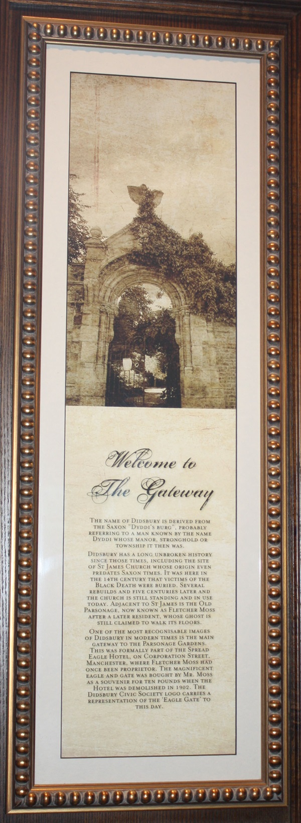
The text reads: The name of Didsbury is derived from the Saxon “Diddi’s Burg”, probably referring to a man known by the name Dyddi whose manor, stronghold or township it then was.
Didsbury has a long unbroken history since those times, including the site of St James Church whose origin even predates Saxon Times. It was here in the 14th century that victims of the Black Death were buried. Several rebuilds and five centuries later and the church is still standing and in use today. Adjacent to St James is the Old Parsonage, now known as Fletcher Moss after a later resident, whose ghost is still claimed to walk its floors.
One of the most recognisable images of Didsbury in modern times in the main gateway to the Parsonage Gardens. This was formally part of the Spread Eagle Hotel, on Corporation Street. Manchester, where Fletcher Moss has once been proprietor. The magnificent eagle and gate was bought by Mr Moss as a souvenir for ten pounds when the Hotel was demolished in 1902. The Didsbury Civic Society logo carries a representation of the ‘Eagle Gate’ to this day.
A print and text about Charles Edward Stuart – ‘Bonnie Prince Charlie’.
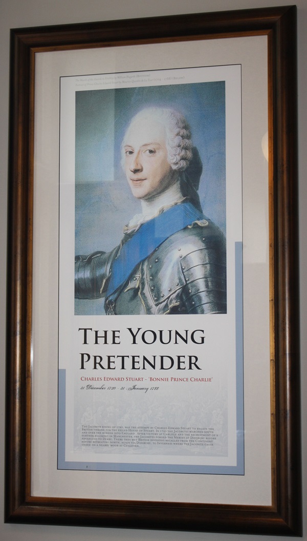
The text reads: The Jacobite rising of 1745, was the attempt by Charles Edward Stuart to regain the British throne for the exiled House of Stuart. In 1745 the Jacobites marched south and over the border into England. After victory at Carlisle and the recruitment of a further regiment in Manchester, the Jacobites forded the Mersey at Didsbury before advancing the Derby. There they met British division recalled from the Continent before retreating north, again via Didsbury, to Inverness where the Jacobite cause ended on a nearby moor at Culloden.
A print and text about Rupert, Count of Palatine of the Rhine, Duke of Bavaria, 1st Duke of Cumberland, 1st earl of Holderness.
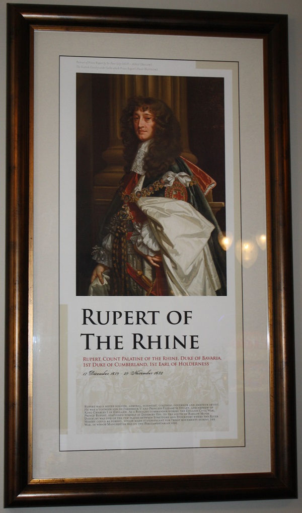
The text reads: Rupert was a noted soldier, admiral, scientist, colonial governor and amateur artist. He was a younger son a Frederick V and Princess Elizabeth Stuart, and nephew of King Charles I of England. As a royalist commander during the English Civil War, Prince Rupert, stationed himself at Didsbury Ees, to the south of Barlow Moor. Didsbury was one of the few places between Stretford and Stockport where the River Mersey could be forded, which made it significant for troop movements during the War, in which Manchester was on the Parliamentarian side.
A photograph and text about the Manchester Ship Canal.
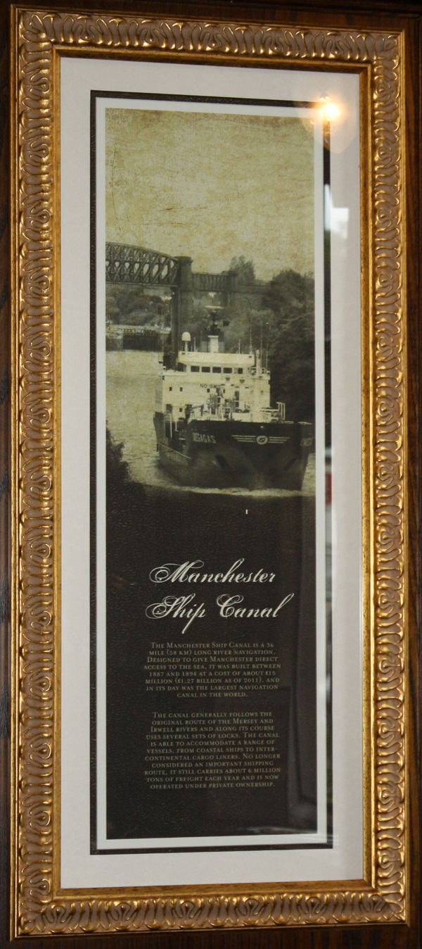
The text reads: The Manchester Ship Canal is a 36 mile (58km) long river navigation, designed to give Manchester direct access to the sea. It was built between 1887 and 1894 at the cost of about £15 million (£1.27 billion as of 2011), and in its day was the largest navigation canal in the world.
The canal generally follows the original route of the Mersey and Irwell rivers and along its course uses several sets of locks. The canal is able to accommodate a range of vessels, from coastal ships to inter-continental cargo liners. No longer considered an important shipping route, it still carries about 6 million tons of freight each year and is now operated under private ownership.
A photograph and text about The Shirley Institute.
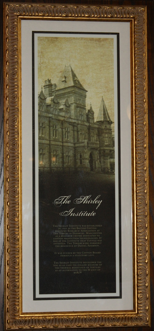
The text reads: The Shirley Institute was established in 1920 as the British Cotton Industry Research Association at The Towers in Didsbury, Manchester as a research centre dedicated to cotton production technologies. It was at the Institute that Ventile was invented. The Towers were formerly the residence of Daniel Adamson.
It was funded by the Cotton Board through a statutory levy.
The Shirley Institute developed the tog as an easy-to-follow measure of the thermal resistance of textiles as an alternative to the SI unit of m2K/W.
A print and text about Daniel Adamson.
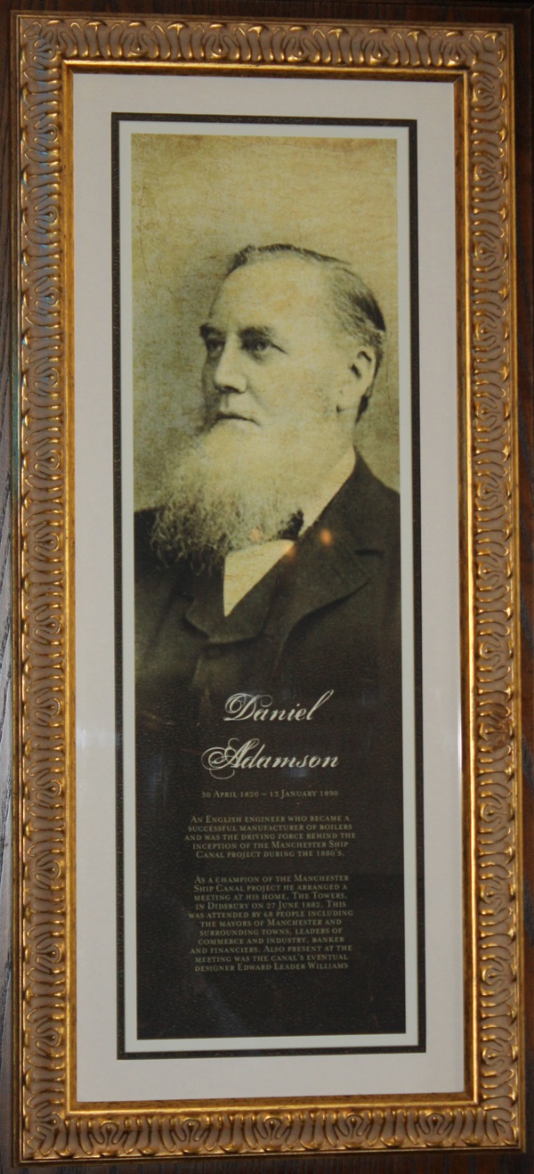
The text reads: An English engineer who became a successful manufacturer of boilers and was the driving force behind the inception of the Manchester Ship Canal project during the 1880’s.
As a champion of the Manchester Ship Canal project he arranged a meeting at his home, The Towers, in Didsbury on 27 June 1882. This was attended by 68 people including the mayors of Manchester and surrounding towns, leaders of commerce and industry, bankers and financiers. Also present at the meeting was the canal’s eventual designer Edwards Leader Williams.
A photograph and text about Francis French.
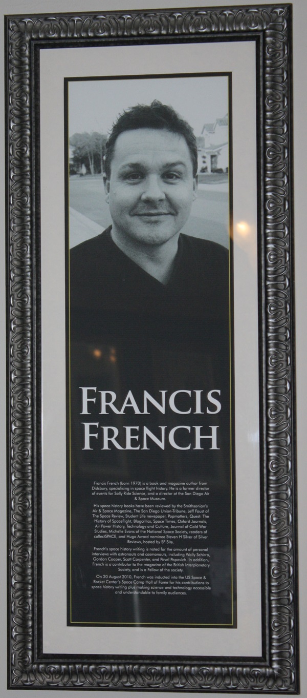
The text reads: Francis French (born 1970) is a book and magazine author from Didsbury, specialising in space flight history. He is a former director of events for Sally Ride Science, and a director at the San Diego Air & Space Museum.
His space history books have been reviewed by Smithsonian’s Air & Space Magazine, The San Diego Union-Tribune, Jeff Foust of The Space Review, Student Life newspaper, Popmatters, Quest: The History of Spaceflight, Blogcritics, Space Times, Oxford Journals, Air Power History, Technology and Culture, Journal of Cold War Studies, Michelle Evans of the National Space Society, readers of collectSPACE, and Hugo Award nominee Steven H Silver of Silver Reviews, hosted by SF Site.
French’s space history writing is noted for the amount of personal interviews with astronauts and cosmonauts, including Wally Schirra, Gordon Cooper, Scott Carpenter, and Pavel Popovich. In addition, French is a contributor to the magazine of the British Interplanetary Society, and is a Fellow of the society.
On 20 August 2010, French was inducted into the US Space & Rocket Center’s Space Camp Hall of Fame for his contributions to space history writing plus making science and technology accessible and understandable to family audiences.
A photograph and text about Didsbury Capitol Theatre.
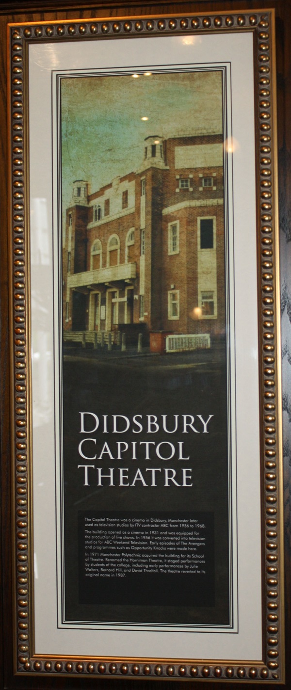
The text reads: The Capital Theatre was a cinema in Didsbury, Manchester later used as television studios by ITV contractor ABC from 1956 to 1968.
The building opened as a cinema in 1931 and was equipped for the production of live shows. In 1956 it was converted into television studios for ABC Weekend Television. Early episodes of The Avengers and programmes such as Opportunity Knocks were made here.
In 1971 Manchester Polytechnic acquired the building for its School of Theatre. Renamed the Horniman Theatre, it staged performances by students of the college, including early performances by Julie Walters, Bernard Hill, and David Threlfall. The theatre reverted to its original name in 1987.
A photograph and text about St James Parish Church.
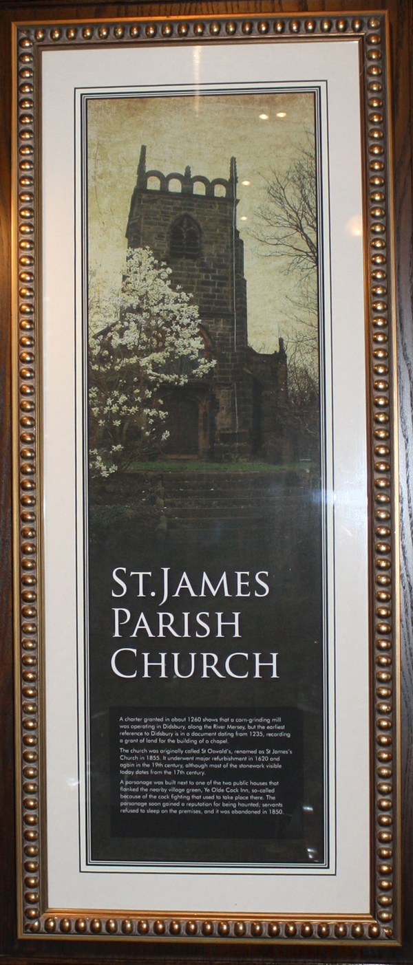
The text reads: A charter granted in about 1260 shows that a corn-grinding mill was operating in Didsbury, along the River Mersey, but the earliest reference to Didsbury is in a document dating from 1235, recording a grant of land for the building of a chapel.
The church was originally called St Oswald’s, renamed as St James’s Church in 1855. It underwent major refurbishment in 1620 and again in the 19th century, although most of the stonework visible today dates from the 17th century.
A parsonage was built next to one of two public houses that flanked the nearby village green, Ye Olde Cock Inn, so-called because of the cock fighting that used to take place there. The parsonage soon gained a reputation for being haunted, servants refused to sleep on the premises, and it was abandoned in 1850.
Photographs and text about the Manchester Carriage and Tramways Company.
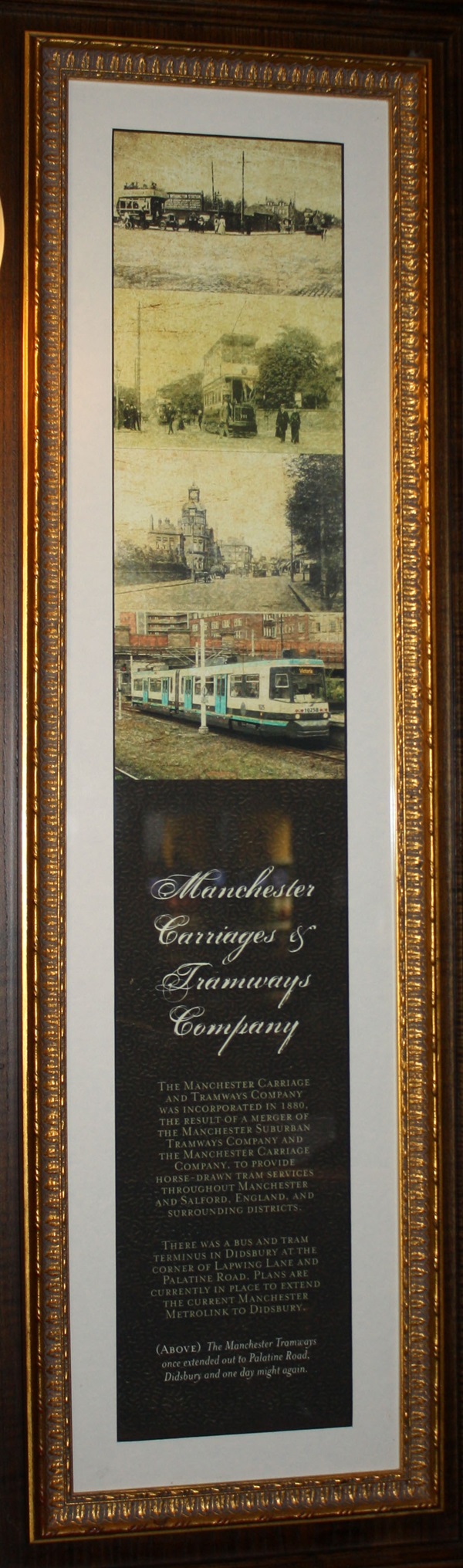
The text reads: The Manchester Carriage and Tramways Company was incorporated in 1880, the result of a merger of the Manchester Suburban Tramways Company and the Manchester Company and the Manchester Carriage Company, to provide horse-drawn tram services throughout Manchester and Salford, England, and surrounding districts.
There was a bus and tram terminus in Didsbury at the corner of Lapwing Lane and Palatine Road. Plans are currently in place to extend the current Manchester Metrolink to Didsbury.
Above: The Manchester Tramways once extended out to Palatine Road Didsbury and one day might again.
Photographs and text about disused Midland Railway stations.
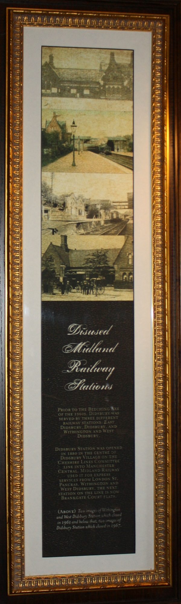
The text reads: Prior to the Beeching Axe of the 1960s, Didsbury was served by three different railway stations: East Didsbury, Didsbury, and Withington and West Didsbury.
Didsbury station was opened in 1880 in the centre of Didsbury Village on the Cheshire Lines Committee line into Manchester Central. Midland Railway used it for express service from London St. Pancras, Withington and West Didsbury. The next station on the line is now Brankgate Court flats.
Above: Two images of Withington and West Didsbury Station which closed in 1961 and below that, two images of Didsbury Station which closed in 1967.
Photographs and text about the Wilmslow Road bus corridor.
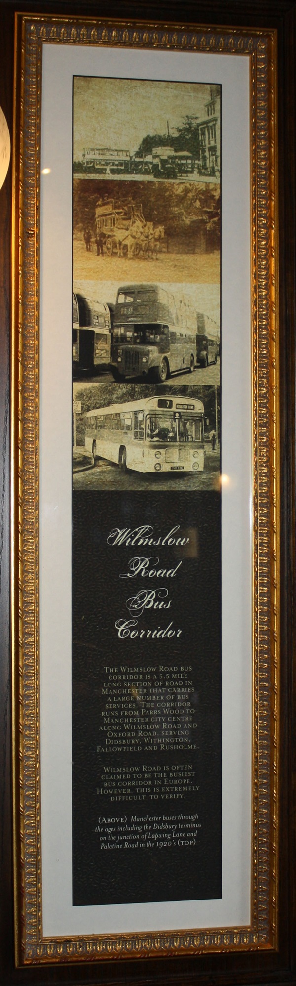
The text reads: The Wilmslow Road bus corridor is a 5.5 mile long section of road in Manchester that carries a large number of bus services. The corridor runs from Parrs Wood to Manchester city centre along Wilmslow Road and Oxford Road, serving Didsbury, Withington Fallowfield and Rusholme.
Wilmslow Road is often claimed to be the busiest bus corridor in Europe. However this is extremely difficult to verify.
Above: Manchester buses through the ages including the Didsbury terminus on the junction of Lapwing Lane and Palatine Road in the 1920’s (Top).
A poem entitled Talent by Carol Ann Duffy.
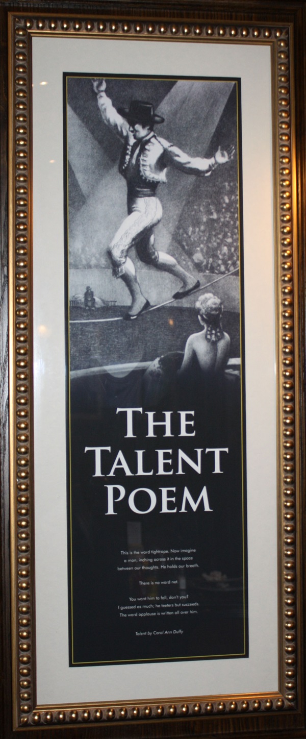
The text reads: This is the tightrope. Now imagine a man, inching across it in the space between our thoughts. He holds our breath.
There is no word net.
You want him to fall don’t you? I guessed as much; he teeters but succeeds. The word applause is written all over him.
A print and text about The RSPB.
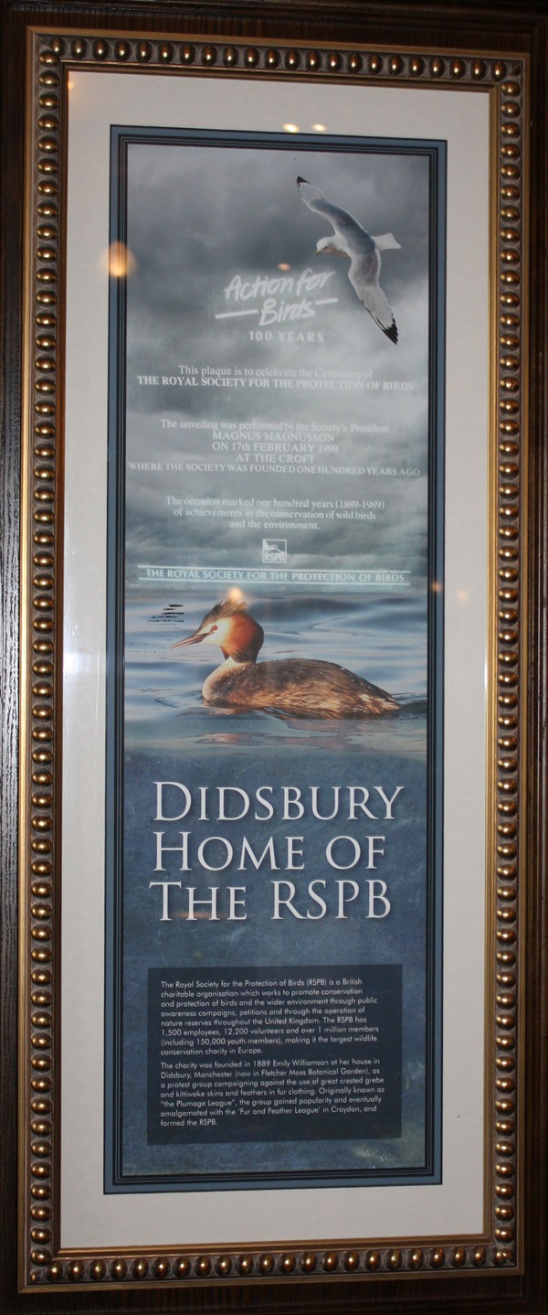
The text reads: The Royal Society for the Protection of Birds (RSPB) is a British charitable organisation which works to promote conservation and protection of birds and the wider environment through public awareness campaigns, petitions and through the operation of nature reserves throughout the United Kingdom. The RSPB has 1,500 employees, 12,200 volunteers and over 1 million members (including 150,000 youth members), making it the largest wildlife conservation charity in Europe.
The charity was founded in 1889 by Emily Williamson at her house in Didsbury, Manchester (now in Fletcher Moss Botanical Garden), as a protect group campaigning against the use of great crested grebe and kittiwake skins and feathers in fur clothing. Originally known as “the Plumage League”, the group gained popularity and eventually amalgamated with the ‘Fur and Feather League’ in Croydon, and formed the RSPB.
A watercolour painting entitled St James Church, by local artist Joan Bradley.
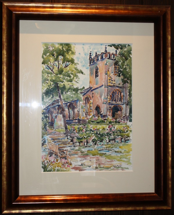
This painting is of the Parish Church of St James which was built in Norman Times and is mentioned in the Doomsday Book. There is a twin church in Northenden built at the same time.
A watercolour painting entitled The Gatehouse, Fletcher Moss, by local artist Jan Cartain.
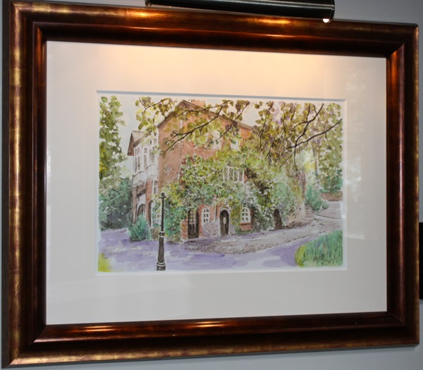
The building is referred to as ‘The Croft’ and originally belonged to the botanist, Robert Wood Williamson, who sold the house and gardens to Alderman Fletcher Moss in 1912.
External photograph of the building – main entrance.
If you have information on the history of this pub, then we’d like you to share it with us. Please e-mail all information to: pubhistories@jdwetherspoon.co.uk